Beween 2012 and 2024 I have been teaching in different Universities in Germany and EU. Initially the subjects were Branding and Communication Design and later Smart City Design and Planning at the HCU (Hafencity University Hamburg) and Smart City Design at the Macromedia FH in Berlin. Its a Mix of Augmented Reality, Mobility and Tactical Urbanism.
I / O the title of this section means that I very much appreciate the dialog with my students!
° ° °
HCU Hamburg, City Planning
Neuemobility.com
…the Metaverse in Hamburg
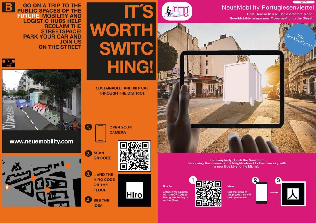
The Instructions still work here, so give it a try with your Smartphone!
A Seminar at the HCU in the field of city planning (BA). The Students were asked to develop post-corona mobility scenarios for a specific district (the ‘Portugiesenviertel’) in the City of Hamburg. The imagination was also stimulated by the ICT 2021 Festival (the ‘Olympics of Transportation’) that took place during that time in Hamburg.
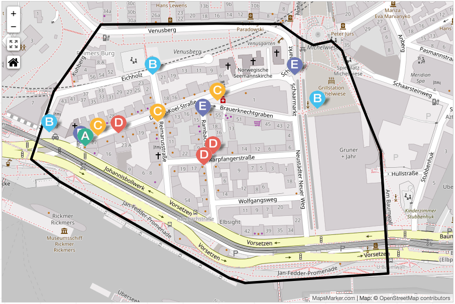
On the spots the students pinned Tags on the ground, and with conventional smart phones the installations and models could be seen (p.s. this still works now if you follow the step by step on the posters above). It was important to allow the whole public to try the concepts, so the posters and models needed to be with Simple UXUI and attractive design. Technology used was ARJS Open Source Code..
Article about the Seminar on Linkedin >
FH Joanneum Graz, Austria
200 Years Bicycle
2 Week Workshop, 200 years bicycle. Communication Design Students @Joanneum Graz.
This Project was supervised by the BMVI and held in collaboration with the Graz and Berlin Bike Citizens.
Valentina Gatterer
° ° °
HCU Hamburg, City Planning
Grassbrook Bicyclebridge
Stadtplanung @ Hafencity Universität Hamburg (WS 20/21)
Lighthouse project: Bicycle bridge over the Norderelbe River. The new district of Grasbrook is to be connected to downtown Hamburg via the Hafencity through a bicycle bridge that meets the mobility requirements of the new quarter. This idea originates from the coalition agreement between the Greens and the SPD for the 2019 Hamburg state election, and the seminar deals with optimal solutions for this lighthouse project.
360° drone panorama shots are a novelty of the project, as well as the use of geolocation data to document mobility and serve as a basis for (visual) representations of projects and ideas.
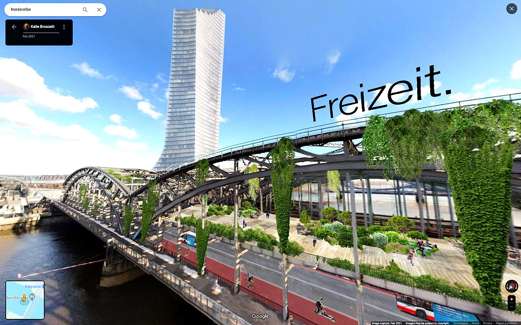
Article about the Seminar on Linkedin >
° ° °
HAW Hamburg, KODE
CORONA VELOROUTEN HAMBURG
During the Corona Pandemic, there was a strong tendency for more Cycling, and hence for PopUp Cycling routes as well. Some got manifested as a test (and will be kept later), some are still lacking. To promote them and to stimulate cycling in general, the students of the KODE (Communication Design) class were producing (Filming, Motion Design, Sound etc) 30 second spots. Icing on the cake: The Spots were broadcasted on the local TIDE TV television station for the summer.
Jannica, Laura KODE Hamburg
° ° °
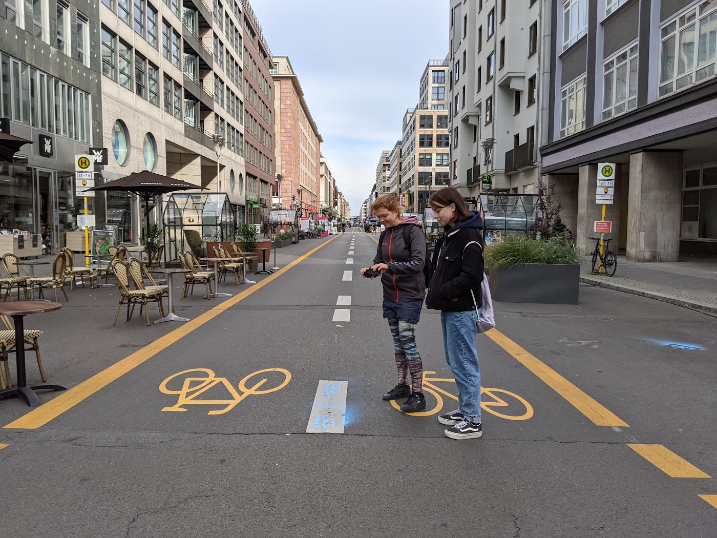
CityLAB Berlin, Summer School
Verkehrsversuch Friedrichstraße Berlin
The closure of Friedrichstraße in Berlin has been a controversial topic, especially throughout 2023 and beyond. This measure was part of a pilot project aimed at reducing traffic and promoting cycling and pedestrian zones in the city center.
To show new ideas for the Cycle and Pedestrian Traffic on Friedrichstraße that go beyond conventional planning ideas, the Smart City Students use 360 Visualisations that link to Social Media (for Sharing and Commenting etc.).
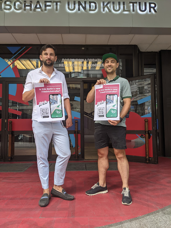
The project was supported by the Russian House on Friedrichstraße and also by the Technology Stiftung Berlin and the CityLAB Berlin.

Students of the Berlin CityLAB Summer School control the graffiti tag that launches the 360° Experiences on Facebook
Smart City Design, FH Macromedia Berlin
Verkehrsversuch Berlin Friedrichstraße Russisches Haus
Right before the Invasion in the Ukraine by Russia we had the last open moments of the Russian House on Friedrichstrasse Berlin to present the Results of the Smart City Seminar dealing with the Verkehrsversuch for a new Mobility in the Capitol. The ideas are 360 degree scenarios on Google Maps that show a new understanding of the Street(s).
Here are some of the results:
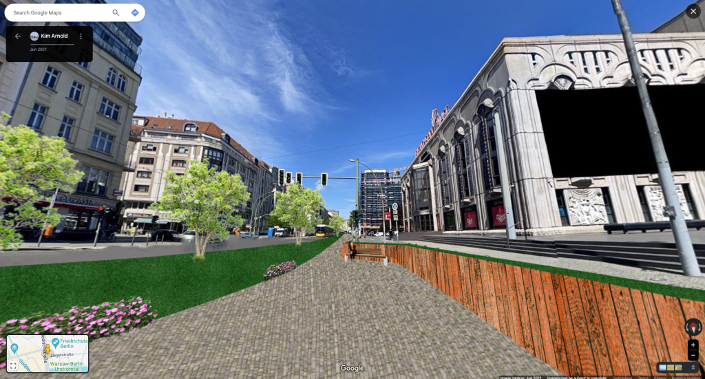
Kim arnold
The Revival of the Palace
The street in front of Friedrichstadtpalast is using the available space sufficiently, where pedestrians are in the foreground. Biophilic design and human centric approaches are incorporated for pedestrians to enjoy the space and its benefits.
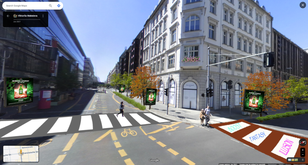
Viktoriia Makeieva
GREEN BOULEVARD
Welcome to the Green Boulevard! Trees will provide you with fresh air, shade and reduce the dust. Digital panels in front of the restaurants and stores can be used to place your orders right from the street. Enjoy also our new seating options along the boulevard while waiting for your delivery. And more safety for pedestrians is guaranteed, thanks to our artsy crosswalks.
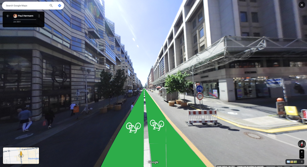
paul herrmann
art walk’n’ ride
The historic city center deserves an Art Mile. Connect your phone to our audio tour and experience the artsy side of Friedrichstraße. We’ve invited local and international artists to tell their memorable Berlin story. Be invited to walk along the boulevard or enjoy a ride while taking your tour.
Talks with STRELKA INSTITUTE also faltered due to the political situation.. We had an interview with the Stakeholders in the Russian House just days after the invasion in the Ukraine, very nervous!
° ° °
Smart City Design, FH Macromedia Berlin
NEW NORMAL
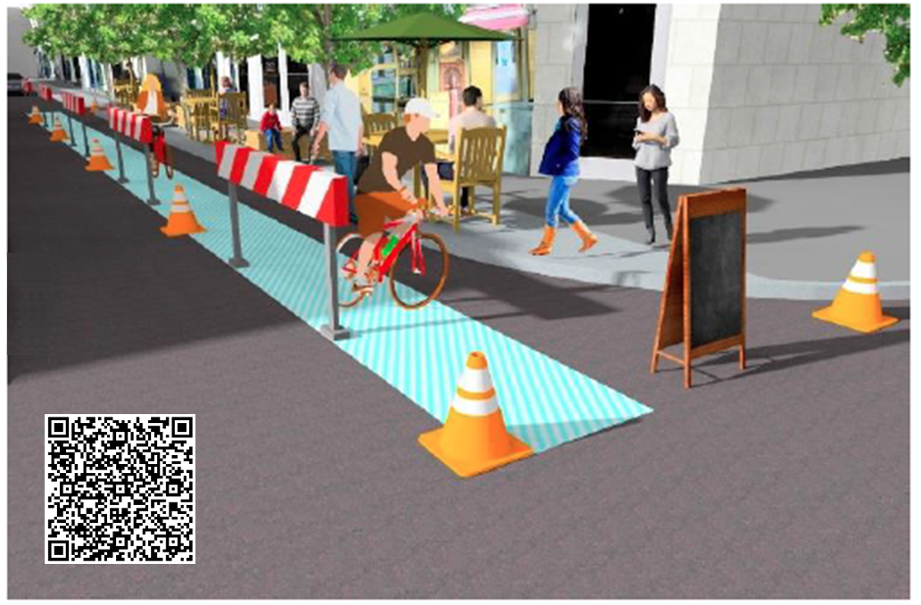
Bergmannstrasse Berlin, Smart City Design (Macromedia FH Berlin)
Tactical Urbanism (to deal with Corona) was the leading theme for the suggested Changes on Bergmannstrasse in Kreuzberg Berlin. To find changes that improve the use of the Street in the Kiez, and allow equal joy for everybody, regardless of the kind of mobility. This of course meant that some had to give to allow equal access to the space. The ideas were integrated into Google Street View, where they can still be visited. Later the City made some more changes to the street (based on our suggestions?).
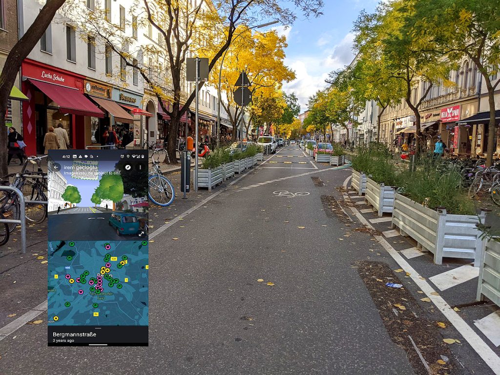
Mobility Scenario for the Bergmannstraße in Kreuzberg Kiez Berlin, visible as 360° Panoramas on Google Street View.
The Smart City Design Class used new UIUX Methods for the design of the public space, asking for the different needs and wishes of a range of Personas and aligned them in the public design explorations. Also Heatmaps (of the Mobility Use of the Street) and KI for the measurement of Traffic (Cars, Bicycles and Pedestrians and also eScooters) were used.
Some of the Lectures were supported by Google Sidewalk Lab Toronto. Their City Building methods inspired the students and the early public video presentations of Sidewalk Lab were important examples for participation methods.
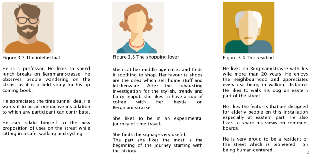
Agnes Okoh “Lunch hour plaza“
More about the NEW NORMAL Seminar here on LinkedIn >
° ° °
Designhochschule Schwerin, STEG Hamburg, BMW AG
First Mover
Motion Design
First Mover is a project by the Hamburg STEG that was initialised by BMW AG and the Hamburger Hochbahn (now SWITCHH) to gather the public Opinion on exchanging Car Parking places for spots that are dedicated to alternative Mobility (for example Sharing Cars). Workshops and Information were given and the Karlsruhe Institute for Technology (KIT) „Urban Travel Monitor“ was used for the research.
My part of the project was to make an informal Motion Design Video that explains the benefits and the whole subject online. To do so, I used my students at the Designhochschule Schwerin for Designing and Producing, and also for Presenting to the group of Stakeholders. I am very proud of the small group of Communication Design students that learned After Effects in that Seminar, produced all the assets, wrote the script, got the client approval and even managed speaker and music in one term. CONGRATULATIONS!


Macromedia VFX Design
AI Motion Previz
In this Seminar in VFX we explored the use of (early 2022) AI tools to generate the Urban Street Scenes. Some of the Vehicles were also prompted (with some interesting mistakes..). Overall Theme was a changed mobility of the (not so distant) future, where Cars drive for themselves and Glasses can show the best way for cyclists.. #speculative design. Are we there yet?